
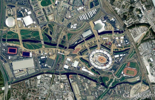

On Friday, the Google Maps and Google Earth teams released a large batch of new high-res imagery that it collected over the past year. Included in the drop are high resolution aerial and satelite images from 25 cities and 72 countries around the world. Most exciting, at least for those of you caught up in the excitement of the Summer Games, is the inclusion of images of the Olympic Park and Olympic Village in London taken this past May. You can see the Olympic Stadium in the final stages of constructions in the lower right of the above image. Hop on Google Maps or Google Earth to access the new images.
[Google Lat Blog via Tech Radar]