
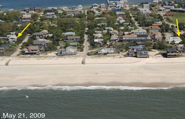

These shocking aerial photos show the damage that Hurricane Sandy did to the shorelines of New York and New Jersey. The before-and-after photos are part of a survey of the damage being conducted by U.S. Geological Service.
USGS Director Marcia McNutt says, "Sandy taught us yet again that not all Cat-1 hurricanes are created equal. We have seized this opportunity to gather unique data on a major coastline-altering event."
The USGS flies over areas before and after storms to collect images of the coastline likely to be hit by the storm. This allows scientist to understand which areas are likely to suffer the most damage during future storms.
[via Daily Mail UK]