

The east coast is currently in a state of emergency as Hurricane Irene moves its way up the coastline. If you're like us, you've been keeping a digital eye on the storm, tracking its every movement to see when (and if) it will hit your 'hood. If you haven't been doing that, well, you should. There are three really good ways to track Irene. Check 'em out below.
Weather Underground's WunderMap
Weather Underground's WunderMap works to cover all storms around the nation, but it's now focused on Irene. Check the WunderMap and zoom into see surprisingly accurate localized radar info for a particular city, town, or area.

The New York Time's Hurricane Irene Tracking Map
Using Google Maps data, the folks at the NYT put together an attractive animated map of Irene's path. Click through the three Map Views to see the hurricane from different perspectives, check the Wind Speed chart to see how strong the storm is raging, or peep the related stores on the right sidebar to get up-to-date news coverage from the Times.
![]()
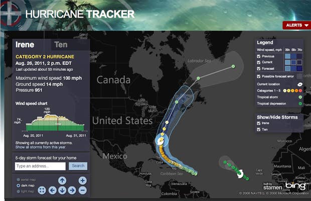
Weather Channel's Hurricane Tracker
Weather.com's Hurricane Tracker loads in all the info you need to know: wind speed, trajectory, related storms, ground speed, and pressure. If you want to check it on the go, you can download Weather.com's iPhone and Android app.
![]()