

For a time, seismologists thought there was an earthquake in North Korea, but it turns out all that rumbling was a series of nuclear tests.
That's according to Mashable's Alex Fitzpatrick, who reports that entering the U.S. Survey's coordinates in Google Maps for the epicenter of the so-called earthquake calls up the precise location of the tests.
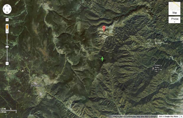
Recently, Google released new maps of North Korea drawn up with help from activist cartographers. Indeed, the windy roads surrounding the test site are labeled "Nuclear Test Road," right near a complex tagged "nuclear test facility." As Fitzpatrick points out, the spot is where North Korea ran previous nuclear tests from 2006-2009.
You can try entering the coordinates on Google Maps to see what pops up: 41.301°N, 129.066°E. Look out for the Hwasong hulag prisoner camp on the right.
[via Mashable]
LIKE COMPLEX TECH ON FACEBOOK