

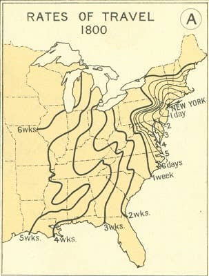
One look at this map, and you'll never complain about your commute again. Taken from 1932's Atlas of the Historical Geography of the United States, it shows how long it took to travel to other parts of the U.S. from New York City back in 1800.
Imagine it taking a month or more to get to New Orleans?